Recent achievements in the fields of microelectronics, data processing and telecommunication systems unfolds a new dimension in the development of geomonitoring and discovery of geological threats.
Armoterra company suggests a new approach to the arrangement of geomonitoring procedures. This approach is based on the continual online monitoring of the area, automatic data processing, early stage detection of geological threats and management decision-making for risk reduction.
Such approach became possible through the bursting development of the Internet, mobile communication systems and wireless technologies. The multipurpose implementation of these achievements for the monitoring of dangerous geological processes allows to arrange geomonitoring process at a completely new standard.
- We use a new generation of cost efficient & low consumption sensors;
- We apply simple and efficient method of inserting sensors into the soil;
- We arrange a multipoint network of autonomic sensors of deformation, resistance and humidity of the soil;
- All sensors in 1 km area are connected to a wireless network, which is connected to GSM or Ethernet network through the router. If there is no GSM network, we optionally use a direct satellite communication by Sky Wave technology.
- All measurements are taken online, the process of measuring, data collection, delivery and processing is highly automatic and remote-controlled;
- Simultaneously with geotechnical measurements we collect meteorological data. This allows to see correlations between geological processes and weather factor, and thus the quality of monitoring and accuracy of risk evaluation are increased;
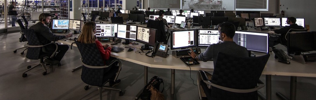
- Web interface is used as a basis of information exchange and provides a possibility to monitor and control the process from any corner of the world with Internet connection;
- The data processing is implemented by 3 level threats criteria. By reaching of each level the particular automatic alarm is triggered. The human factor is excluded (minimised), and the possibility of an early stage detection of the threat becomes possible;
- We implemented the principle of visualisation of a monitored object (area) where sensors are automatically displayed in different colours (green, yellow or red) depending on the degree of deviation from the normal status. So simply by giving a fast look at a monitor one can make evaluation of the degree of danger and localise the threat;
- Our monitoring system regularly sends reports and archives all the parameters of measurements, it analyses the trends and allows to forecast the changes at the monitored object given the geotechnical risks;
- Due to web interface, object visualisation, online access to primary data, reports and forecasts – a client is always highly informed on a status of the monitored object.
IMPORTANT! OUR SYSTEM ALLOWS TO MODEL EMERGENCY RESPONSE DECISION-MAKING PROCEDURE FOR MANAGEMENT & PERSONNEL, AND AUTOMATICALLY ACTIVATES IT IN A CRITICAL SITUATION INCREASING THE EFFICIENCY OF THE ACCIDENT ELIMINATION PROCESS.
If any risks for development of dangerous geological processes are found, our company specialists will always recommend to a client various geotechnical solutions for mitigation or elimination of these risks. Very often prevention measures taken on time are less expensive and help to avoid a disaster.